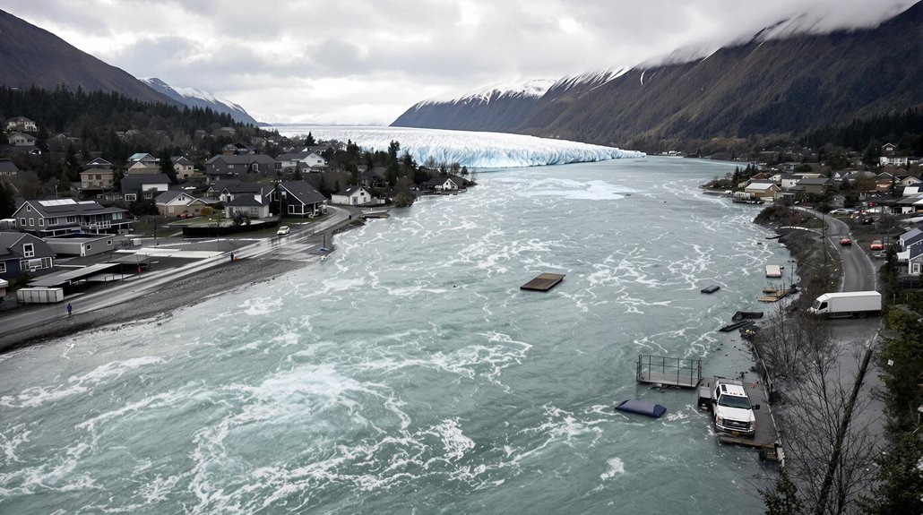
A devastating storm system turned Texas Hill Country into a deadly torrent on July 4, 2025, killing at least 120 people in one of the state’s worst flooding disasters. The catastrophe struck when a slow-moving storm dumped over 12 inches of rain in several hours, causing the Guadalupe River to surge more than 8 meters in just 45 minutes.
The disaster hit Camp Mystic in Kerr County especially hard, where 27 people died as floodwaters swept away more than a dozen cabins. Remnants of Tropical Storm Barry fueled the intense rainfall, which fell on dry, poorly permeable soils after a prolonged dry spell. This combination created perfect conditions for flash flooding that overwhelmed entire communities. The compacted soil from drought conditions significantly reduced the ground’s ability to absorb the sudden deluge of water.
Dry soil and tropical storm remnants created a deadly combination that swept away entire communities.
Satellite images showed floodwaters extending hundreds of feet beyond the Guadalupe River’s banks, reaching far past FEMA’s designated flood zones. The water levels exceeded even the agency’s 0.2% hazard estimation, which represents worst-case scenarios. Private modeling companies suggest that government flood maps underestimate risk, with more than twice as many homes actually in danger than official estimates show. Current FEMA models fail to account for heavy precipitation impacts from extreme weather events, leading to dangerous underestimation of flood potential.
This disaster reflects a troubling national trend. By mid-July 2025, the U.S. recorded over 4,800 flash flooding incidents, marking a 70% increase from the 10-year average. Texas has become a significant hotspot for these events. While 2022 and 2023 saw below-average flooding, scientists link the overall upward trend to a warming atmosphere that can hold more moisture. The increasing frequency of these events is creating a new class of climate refugees as more communities become repeatedly uninhabitable after devastating floods.
Emergency crews conducted hundreds of rescues as widespread power outages and infrastructure damage made the crisis worse. NASA’s Disasters Response Coordination System activated to help Texas emergency managers and FEMA Region 6. Teams used satellite imagery and radar to map flood extents and assess damage in real-time.
The rapid onset caught many residents off guard. Buildings that seemed safe one moment were underwater the next. Continued rainfall after the initial event increased risks for more flooding and landslides.
This summer is on track to become one of the most flood-impacted in U.S. history, with Texas bearing much of the burden.
References
- https://www.accuweather.com/en/severe-weather/is-flash-flooding-getting-worse-summers-soaking-start-may-hold-the-answer/1796230
- https://abcnews.go.com/US/fema-maps-underestimated-risk-catastrophic-texas-flood-data/story?id=123659353
- https://www.cimafoundation.org/en/news/flash-flood-in-texas-an-unexpected-surge/
- https://appliedsciences.nasa.gov/what-we-do/disasters/disasters-activations/texas-flooding-july-2025